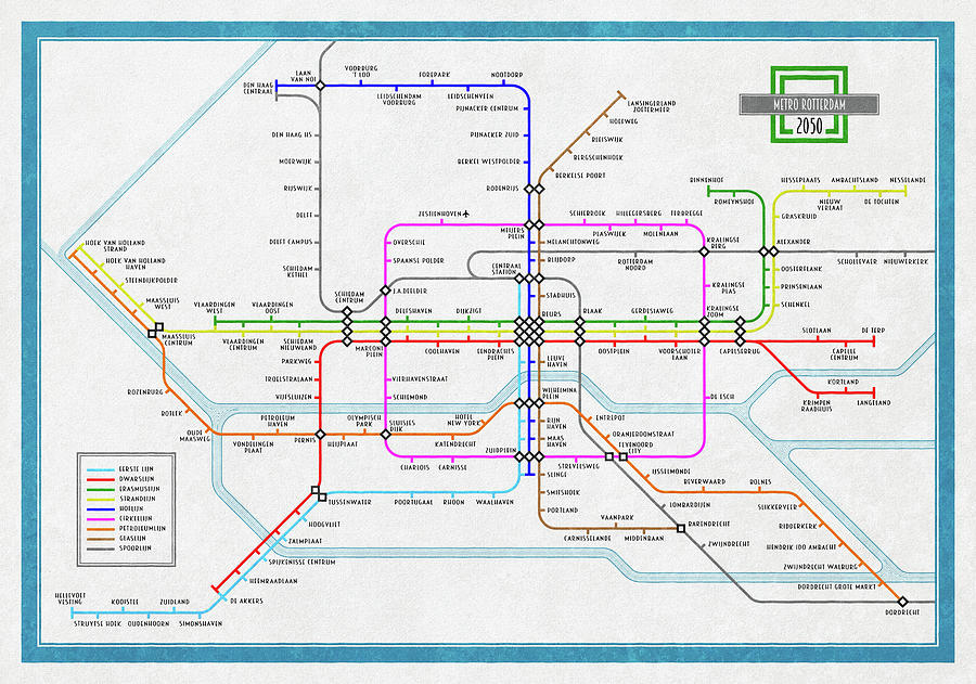
Rotterdam Metro Map 2050

by Frans Blok
Title
Rotterdam Metro Map 2050
Artist
Frans Blok
Medium
Digital Art - Digital Art
Description
A map of the metro network in Rotterdam, The Netherlands, as it may look like in 2050. With some extensions, new stations and three new lines: the Circle Line, the Petroleum Line and the Glass Line. The styling of the map is inspired by Harry Beck's famous 1934 map of the London Underground
Uploaded
January 7th, 2020
Statistics
Viewed 1,485 Times - Last Visitor from Beverly Hills, CA on 04/16/2024 at 6:18 AM
Embed
Share
Sales Sheet
Comments
There are no comments for Rotterdam Metro Map 2050. Click here to post the first comment.


